Joe

Friday 24 February 2012

Wet season in Peru

After a rest day in Cusco and more cold rainy weather it was hard to get enthusiastic about setting off. We where about to head right along Andean high lands on a route dotted with small towns connected by dirt roads and more than likely centred right in the wettest part of the country in the middle of the wet season. This was going to be interesting.


Lots of Water about


Them there hills are big mothers. After lunch in Abancay we left the pavement and wound our way into the network of dirt roads. After 30km and about an 3/4 hour Abancay was still just over there, what the heck, had we been travelling in circles? well this hill was so damn big that it had taken all of that time just to climb up out of the valley.


One of the big climbs


Crops growing up high on the hills


Without an accurate map it was with relieve that at the end of the day a decent size town called Andahuaylas emerged out of the mist. It was obvious that not to many tourist make it through these parts, we got many hola's and waves as we rode around town looking for some accommodation. The next day it was more up and down. Down in the valleys it was tropical and hot, up on the tops it was snowy and cold. Luckily for most of the day it was clear and sunny and we got big views as we traversed big ridges on not so big roads containing rather big buses. Care was required to avoid a head on. The bus drivers over here are nuts. The road just kept on going and this was bloody awesome stuff. We were still up high when the heaven's opened up and it was a cold and wet end to the day as we ascended into Ayaucho.


Break time in Uripa


Removing thermal liners down in the tropics


carnival activites


In Ayaucho we got to enjoy the carnival. Lots of locals dressed up, dancing and singing. Quite a different experience for us than maybe 10 -20 years ago when this area was apparently the centre of terrorism in Peru and off limits to tourists. Up until now we had managed to skirt around the many slips and deberi on the road created by all the rain. The days ride started off well as we attempted to make Huancayo, the largest highlands city in Peru. Before long though we were off down a muddy slippery track that didn't really resemble a road as marked on the map. We consulted a few locals and yes this was the road, well what do you reckon?


After some indecision we slid our way down the trail and and into the unknown. The road improved a bit , the sun was shining, the scenery was great and the riding was sweet, but if it rained we would be in the shit, slippery red mud to be precise. At the next town a conversation of sorts revelled that the road ahead was "no possible" but then it was, no it wasn't, what the hell, is the road possible or not? On edge about what may lay ahead it was difficult not to get frustrated and angry that our simple questions could not be answered. I thanked the locals, had a laugh with them about my bad language skills and headed off up the road with the understanding that there would be a river about 5 km up which may be impassible.


The rio was up and the road badly scoured out but we walked the moto's through without any problems. The problem was just up the road a few more km where a mud slide had engulfed the road for more than a few hundred meters. The bikes powered through until they sunk up to the axles in wet concrete like slop. We pushed em through, us suffering from exhaustion and the motorbikes suffering also, the stony slop binding up in the drive chain, the clutches struggling with the load. That was no fun, damn hard on the bikes too but we were through.


Muddy flood waters


Didn't see the wet concrete sign!


Not far up the road was the next mud slide, bloody hell this is going to grind our bikes to bits- and us too. However, a loader was on the other side busy clearing this one and while waiting we got to chat with the friendly locals who were stranded by the damaged road. The delay was annoying but it was nice to actually spend a bit of time with the interesting people of these parts as apposed to just whizzing by on the bikes and wondering what the heck they get up to. I had the map out and was surrounded by the curious crowd, apparently it would be no problemo through to Huancayo, but I wasn't holding my breath. We carried on along side the muddy flooded river, the road pinched between it and the steep hill sides, in places it was narrow and chiseled into sheer vertical cliffs. The scenery, the dodgy road, the massive flooded river, the unpredictability was all shaping up into an eventful day out.


Hanging with the locals


Perfect road conditions, for trail bikes!


On arrival at the next town we were waved down, "not possible to carry on, the road ahead taken out by the rains and no one working on it " we were told. The seamingly easy task of getting the right information on the road ahead was again proving frustrating. Just as we were about to consider the unpleasant idea of turning around and back tracking for a hole day it seemed that there was an alternative road not marked on our map that was ok . Why didn't you tell us that in the first place? Where was this road and was it actually ok? After several minutes of hair pulling we left in search of our last hope still unsure of what we would find.


As it turned out we found a beautiful little road that had us zig zagging our way up and onto the ridge well above the valley. We were now traversing along the top of a mountain ridge with 360 degree view's, mountains everywhere in the distance. It was late in the day, we were gunning it along this ridge top road, the late light and misty cloud way up high around 4000m adding another dimension to the day. Our luck had turned good, the road out of the slip infested valley was a beauty and clear of any flood damage, and we found some accommodation in the town of Pampas just on dark and with the rain setting in. What a day.


Adobe buildings high up on the ridge


Views up on the ridge


The next morning after the previous days big adventures, Rob needed pancakes for Breaky. After several attempts to order some with mixed results Rob decided that we had to go out back to the kitchen and show the friendly family run restaurant how to make pancakes. It was an eye opener back there, we mixed up our pancakes while right across the table some chicken soup was being prepared, nothing was left to waste as feet were chopped up and bit's went flying, luckily not into our pancake mix!


Fueled up on pancakes and ready to roll


Time for a new tyre at La Casa BuelaHostel- Huancayo,Peru.

Saturday 18 February 2012

Cusco to Mitchu Pitchu

We spent the second and third days in Cusco on guided bus tours firstly around the city then on the second day we had a full day tour to the Sacred valley and viewed a number of Inca sites that were impressive because of the time and labour and thought that went into building these giant structures.

Pisaq. Incas grew potatoes and maize here.

We ended being taken to a more markets than we would have liked.
Ollantaytambo

The following day we had a day of cleaning bikes and doing some maintenance. I decided to change my front sprocket on the Tenere but as usual things didn't go to plan I had problems undoing the nut holding the sprocket on. But we got there. We have become regulars at Paddy's bar where the food is real good and reasonably cheap in the plaza De Armas.   .

We left Cusco and headed for the alternative route to Mitchu Pitchu most people travel up and over the hill out of Cusco to a town called Ollantaytambo by bus then catch a train that takes about two hours to get a small tourist town at the foot of Mitchu Pitchu called Aquas Calientas(sp).
Our route went past Ollantaytambo which is at about 2300m. We then went up and over pass that got to over 4300m. The road was tar sealed and had numerous switch backs. We descended to Santa Maria at approximately 1250m. Where things felt much warmer and we had to strip off all our thermal gear. The hill was long and took us over one and half hours. We lost count of the number of corners.

The intention was to ride from Santa Maria onto Santa Tersea this road was gravel and following a narrow steep road that wound along side of the hill up above a swollen Rio Urumamba.
 This slip just about stopped us. We checked it out. On the left was porridge foot thick mud. I gunned the Tenere into the bog and about 8 metres into I hit a large rock. The bike stopped dead the back wheel came off the ground and I  nearly went over the handle bars. The sudden stop also loosened my handle bars. It took us a few minutes to pull the bike of the porridge. Very amusing for the local youths who thought we were crazy. We tried again and managed after a couple of goes to get the bike up and over on the left side of the slip.


We got another 3-4 kms along the road and were stopped by  300 metre land slide that had completely taken the road in two places. We back tracked back  for 6 km's over the first slip and found a nice hostel   right on dark  called  Yellow River that was a ecolodge down by the roaring river. The hostel was surrounded by tropical fruit trees and was like an oasis to us. The owners Andrew and Titaca were overseas but her parents Olga and Angel looked after .The power was out but they managed to cook a nice meal for us.


The next day we walked for nearly two hours toward Santa Teresa then shared a taxi to Hydro another very small settlement where we had to walk to Aquas Calientes another two hours.
The next day we left yellow river and started walking to Santa Tersea. We walked over the slips and met a taxi at the other side and shared a ride to Hydro another village where the train track starts and take passengers to Aquas Calientes.

Notice the water come out of the mountain. part of the hydro power scheme we presumed.

The walk up the railway line was pleasant the gradient was good, the flooded boiling river was right beside us. We could have caught the train but it didn't leave tell 4.30 and we had heard the walk was pleasant.


The view looking up valley near Hydro


View from our hostel of the flooding. The roar was deafening. You could here the boulders rolling around on the river bed. On the other side of the hotel was the railway line. 

We shot up to Mitchu Pitchu that afternoon with Chris from England and shared the cost of private guide. We had some drizzle but we still had good views. MP was cool but after having seeing so many photos and reading about it neither of us felt that excited about it. We were more impressed with the location and how inaccessible the area is.
The next day Joe and I spent more time walking than I would have liked and I had blisters by the time we walked into the Yellow river lodge again late in the afternoon.


A digger had arrived to clear the the huge slip we couldn't get by on our bikes.The workmen are looking for falling boulders.

 We had another pleasant meal with candles again. The trip out from the Yellow house was uneventful. Joe had Olga on the back of his bike for half the the distance. It also rained and was coldd going back over the pass again. Pleased to get back to our hostel in Cusco. 

Monday 13 February 2012

Peru


Our accomadation in Chivay

Our first day in Peru involved riding on the edge of Lake Titicaca up at 3800m. After a night in Puno we navigated our way to Chivay. The Peruvians aren't to good at using road signs also and we once again diced our way through traffic in the smoggy city of Juliaca and after several partly understood directions from locals we were clad to find our way out of the rat race. Before arriving in Chivay the usual afternoon thunderstorm arrived just as we headed up over 4000m and into the snow. Fortunately we were out of the cold and down in Chivay in quick time.


Chivay is at the head of the Canyon de Colca which along with it's northern neighbour Catahuasi are the deepest in the world. Our plan was to head down the canyon in the morning and then make tracks towards Cusco via a series of back roads. The ride down the valley was some of the best scenery so far, lots of little villages and farming activities on the steeply terraced slopes. We took in the views of the canyon as it rapidly dropped away further down valley and then began our return to Chivay. During our morning down valley a slip come down over the road so a detour up the other side of the valley was necessary. This road was very narrow and obviously saw little traffic and the muddy surface was causing all sorts of troubles for all the tourist buses that were also directed along the detour. Not to difficult on the motos though and we raced past all the stuck buses and on through some very sleepy little towns.


Canyon del Colca


Lady selling goods in the canyon
 
Unbelievably we bumped into the German bikers who we rode with back during our first few days in Bolivia. We had lunch together and exchanged stories before they headed south and we decided to delay our departure north to the following day as the afternoon thunderstorms had arrived early and we knew our planned route involved high passes and vast distances. Instead we fulled in the afternoon with some bike maintenance, I changed the engine oil and filter on the DR while Rob spent a couple of hours masterfully reshaping his spare rear brake pads to fit. Yes, once again he was given more incorrect parts for the Tenere!

The Germans departing Chivay

Just as hoped we set off in the morning under clear skies. We were soon climbing up high on a narrow dirt road and before long were up in the snow. The road was a slushy mess and dodging masses of put holes in about 40m of visibility in the mist was going to take several hours at our average speed, not the most fun riding. We stopped briefly up on the mountain top when we spotted a hut and a mob? of Llama's. A lady approached us out of the mist all dressed up in traditional kit, she seemed interested in what we were up to or did see just want some money like the many other people? We had a brief chat, nice lady, she was running around the farm barefoot in the snow, they must breed em tough in these parts I thought as we carried on along the road of pot holes.


Snow up on the tops

 
Where the hell are we? what the hell is along the road in front of us? impassable snow, washed out roads or swollen river crossings? And when is the daily thunderstorm going to arrive? Up high in the mountains in the mist this was what was running through my head and as it turned out these thoughts were a regular occurrence through out the day. We summited the pass and straight away the skies cleared offering views of the surrounding mountain tops, the road improved and it was a different ride, this is more like it!
The roads on the map seemed to be making sense and we were making good ground, we might make it out of here yet!

"Up here on the left there should be a junction were we make a left turn" I thought. "Yes, there it is but what the F, that looks like a goat trail! Check the map again, yep road heading off in that direction looks right, it does have a sign at least but the towns don't match the ones on the map! Well it's heading in the right direction must be right."

So we headed off on the road indicated on the map but in reality we rode over a broken up coarse way across the river round large bog holes and up a track that resembled a creek bed more than a road. We were heading up over another pass and had around 70km to the next town. The riding was fun but I couldn't stop thinking, were the hell, what the hell again.


one of the creek crossings


washed out causeway


Interesting rock formations on way to Yauri


We crested the pass and all of a sudden we were actually on a road again and immediately the pace picked up and we cruised down valley past interesting rock formations and apart from a couple of mishaps in a creek crossing and a difficult river crossing it was an enjoyable ride out to the town of Yauri for lunch. From Yauri it was all main roads and fast going, we decided to push on to Cusco and arrived just on dark. It was a big day out and definitely one of our more adventurous days on the bikes.

Sunday 12 February 2012

Lap Paz to Cusco

 The country side was wet from the the storm the night before. We stopped as we left Orou and took this photo of the miners statue. This statue was the only redeeming feature of this city.

The roads were flattish as we headed along the Altiplano we had buses passing us then they would stop at the next small town then pass us again. The country side had small settlements dotted  off to the side of the road. I got the impression people were just getting by.

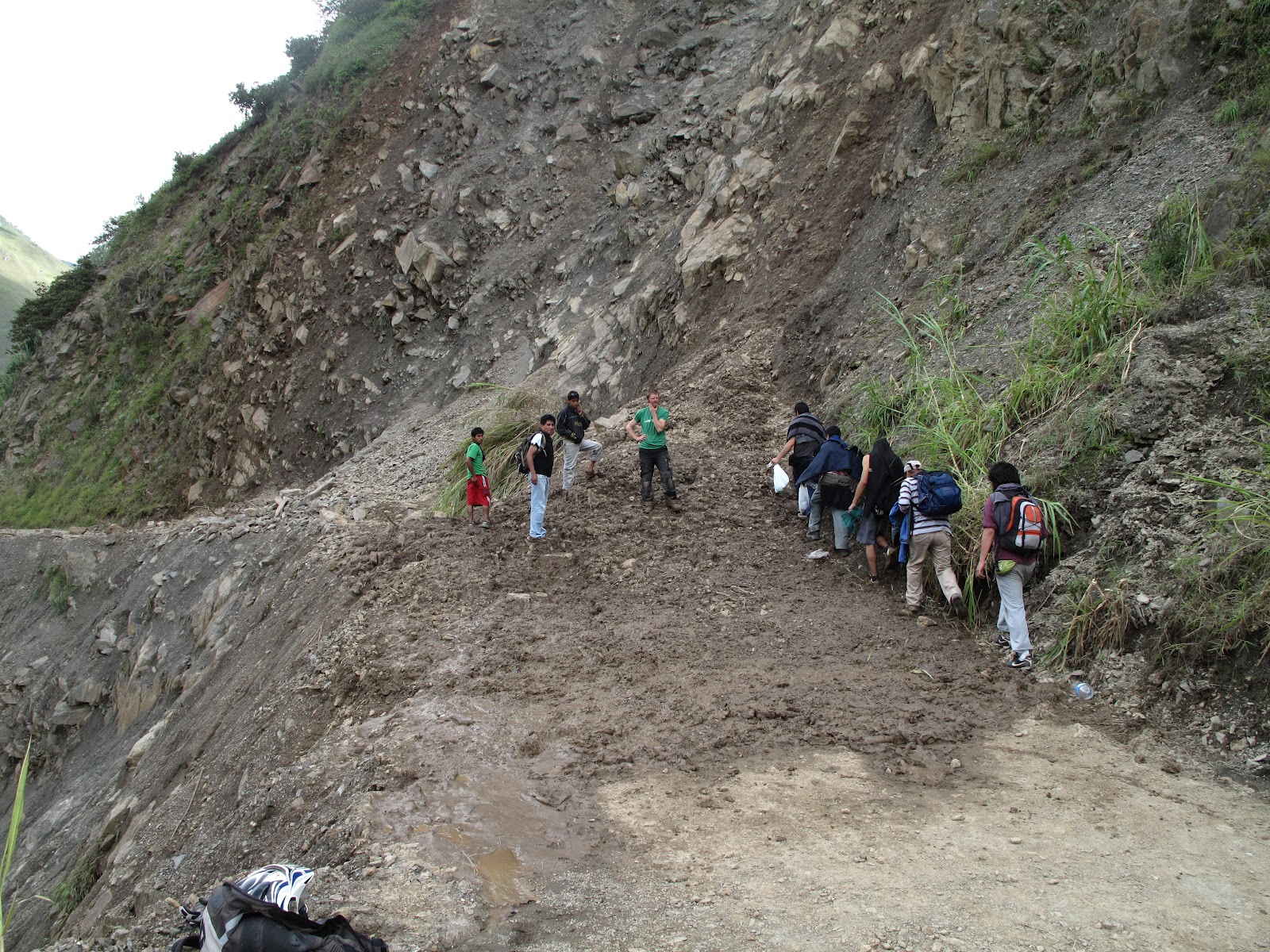
As we got closer to LaPaz we came onto major new road being built beside the current road.A fleet of 40-50  brand new 6 wheel tip Mack trucks were lined up. The only other brand of truck we had seen in Bolivia tell then were Volvo's. The closer we got to Lapaz the worse the road got. There were depressions in the road 20-30cm deep which meant you couldn't easily change your position within the lane.

The volume of traffic about 20 km south  of LaPaz started to back up and we got stuck behind buses and trucks emitting toxic diesel fumes. As we came toward the top of the LaPaz basin we had to deal with four lanes of taxi vans (Collectivos) piling up in front of us.The Police seem to control numbers of Collectives on the road by making them fill up with passengers b4 moving on.

We stopped at the top of the basin over looking LaPaz and tried to figure out where the hotel was we had been recommended to us.

 The trip down the hill into LaPaz went well and we got our hotel with out too much back tracking.

We walked into the centre of the city which was only 8 minutes away. The hotel had good wifi and we managed to get the price down a little.
We came across some Bolivian people in traditional dress singing as we made our way down to San Francisco plaza.
Around the Plaza San Francisco area there many shops selling tourist trips onto the Worlds most dangerous highway and trekking trips and Alpaca clothing.

The next day we got going early and headed up and out of LaPaz to do the worlds most dangerous highway on our motorcycles. The signage is non existent and you have to do some route planning before you even start your journey. We climbed up to 4200 metres and we were into a cold damp cloud with minimal visibility. Fortunately we came across a guided mountain bike group and we knew we were going in the right direction.

The mtb were taking off on there first stage which was on tar seal and cold mist, which wouldn't have been that much fun. Fortunately after dropping 400 metres in height the cloud and mist cleared.

We managed to find the start of the gravel road which wasn't well sign posted.

We came across a mountain bike group and were told about all the fatal deaths on the road in one incident a bus had gone over the cliff killing 100 people. We both rode carefully. We met one vehicle coming up the hill, The road is only used by adventurous tourists and mtb companies. The new road was completed in 2007 and took 20 years to build. The mtb trip is a 64 km of descent.15 mtb have died on the trip.

We dropped down to nearly 2000 metres and with all our insulated clothing on I was keen to get out of the tropical rain forest climate of Coroico. The tar seal trip back to LaPaz is a motorcyclist dream with nice pavement great views and lots of nice sweeping bends and switch backs.

Joe took a side trip down South Yungas road which is probably more dangerous  with traffic still using it. He arrived back late after having to get extra petrol from a local.

The trip out of LaPaz caused us a head ache  we had to pick up our laundry, we ended up getting a bit lost and rode through the street market following a delivery truck.We had people jammed up beside us and could barely move, some women whacked me with her fist we eventually got to the laundry. Leaving the city, we had a few problems the Bolivians don't believe in any road signs.We eventually got going and headed for Copacabana at the south end of Lake Titicaca. The usual afternoon rain came.

We had to get a small wooden barge across a small peninsular at San Pablo the barge was twisting and had a fair amount of water sitting in the bottom of it. The area reminds me of Akaroa in NZ with steep treeless hills running down to the water.

We rolled into Copacabana and booked into the first hotel we found.
We had a room with a view over the the lake which was nice. Lots of boats were tied up and looked to be used to ferry people across to Isla del Sol the Inca creation site and birth place of the sun in Inca mythology. There many back packers staying in this small town making the journey across to the island.
The hotel was cheap and we felt like Kings with such great views.


We climbed to the top of the hill to take this photo. It was only a short climb but when your already at 3800 metres you start understand about the benefits of altitude training.
The next day it was raining in the morning and we decided to stay another day. Then the rain cleared so we decided to make for Puno in Peru. The boarder crossing was only 8km away. We had two bus loads of back packers waiting at the the boarder. Amazingly they were all processed within 20-30 minutes. A good start to our entry into Peru.